Scattered Storms Possible Wednesday Afternoon, Evening
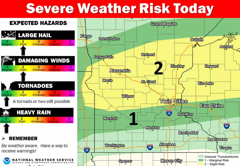
UNDATED -- Scattered thunderstorms are expected to develop along a weak boundary across central Minnesota late Wednesday afternoon through the evening.
Any storm that does develop will have the potential for large hail and damaging wind gusts, with the best chance north of a line from Montevideo to the Twin Cities to Bloomer, Wisconsin.
National Weather Service
Severe thunderstorms are also possible Thursday evening into Thursday night, with the best chances along and south of a line from Willmar to the Twin Cities to Eau Claire.
The primary threats will be large hail and damaging winds. In addition, a few storms over southeast Minnesota into western Wisconsin may produce heavy rain which could lead to isolated flooding issues.

Enter your number to get our free mobile app
See Inside the Planters Nutmobile
More From Mix 94.9