Update: Tornado Watch Issued Until 10:00 p.m.
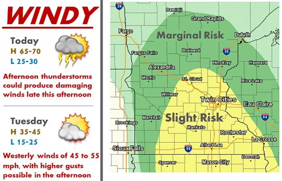
UNDATED - Today will be warm, but a strong cold front will bring a few showers and thunderstorms this afternoon and evening. A few storms could be strong to severe.
Very strong winds will develop Monday evening and last through Tuesday. Gusts over 50 mph are possible, especially in western Minnesota.
Forecasters say tornadoes are possible from Arkansas and Oklahoma to Minnesota as warm weather reaches well into the nation's midsection.
The area at the greatest risk Monday runs from near Tulsa, Oklahoma, and Joplin, Missouri, into eastern Iowa and northwestern Illinois. Storms should begin late Monday afternoon and continue into the night. Some tornadoes could be strong, with winds above 111 mph.
The storm threat covers 22 million people.
Isolated storms with the potential to produce tornadoes are forecast to form in eastern Kansas and eastern Oklahoma and move into Missouri. Supercell storms are also possible in the upper Midwest.
As a cold front approaches, high winds will be the greater threat.
Strong winds from the south will carry a threat into Illinois, Indiana and Wisconsin overnight.
The National Weather Service contributed to this story.
More From Mix 94.9